Hello everybody! Sorry for such a long break between this post and the last one. Been a busy Summer and I got quite a bit sidetracked from this blog. From here on, I will make it a priority to post on a more regular basis. Especially since we are getting close to entering our active weather season here in the Pacific Northwest! Anyways, let's get into the forecast...
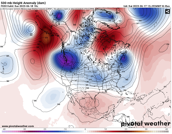
As of today, September 1st, it is now Meteorological Fall!🍂 As if the atmosphere heard the news, cooler weather with some rain is forecasted for this weekend into next week. This weather will be moving into the region due to a series of low-pressure troughs from the north/northwest (see below). This will allow the PNW to cool down and add some rain chances into the forecast...
Trough (blue) and ridge (red) positions.
Surface temperature departure from normal for Monday the 4th.
The first rain chances will spread into parts of Oregon and Idaho as some monsoonal moisture moves north (see below). Some of this will be in the form of thunderstorms that will be capable of small hail, lightning, heavy rain, and gusty winds. A portion of this activity may move into the Portland Metro late Saturday. During Saturday night and Sunday morning, some showers/thunderstorms associated with the monsoon moisture may get into portions of western Washington. This is no way a guarantee as models are having a hard time agreeing on this feature...
Depiction of where showers/t-storms may be on Saturday afternoon.
The next precipitation chance will be during the day on Sunday as our first trough moves on through. Mainly scattered showers with this. Thunderstorms will also continue for the interior northwest...
Depiction of where showers/t-storms may be on Sunday afternoon.
After Sunday's precipitation chances, we will mostly have a break except for Idaho and Montana where widespread rain and thunderstorms continue moving east. Models then show another trough moving through the region around the Wednesday timeframe (see below). So far this looks to be a rather weak system that will mostly bring some showers to places west of the Cascade crest in Washington...
Depiction of where showers may be on Wednesday morning/afternoon.
Beyond Wednesday, models start disagreeing on whether another trough moves through or if a ridge builds over the region. Right now it is looking more likely a ridge will form over the West Coast and bring warmer and nicer conditions though we won't really know for sure until later next week. Until then, enjoy the cooler weather as much as you can and I will try to be back with another post later next week! God bless and take care.
.png)


.png)
.png)


Comments
Post a Comment